
Dynamic World is a new landcover product developed by Google and World Resources Institute (WRI). It is a unique dataset that is designed to make it easy for users to develop locally relevant landcover classification easily. Contrary to other landcover products which try to classify the pixels into a single class – the Dynamic World (DW) model gives you the probability of the pixel belonging to each of the 9 different landcover classes. The full dataset contains the DW class probabilities for every Sentinel-2 scene since 2015 having <35% cloud-cover. It is also updated continuously with detections from new Sentinel-2 scenes as soon as they are available. This makes DW ideal for change detection and monitoring applications.

A key fact about this dataset is that Dynamic World is not a ready-to-use landcover product. Users are expected to fine-tune the output of DW with local knowledge into a final landcover product. Since DW provides per-pixel probabilities generated by a Fully Convolutional Neural Network (FCNN) model, a lot of difficult problems encountered in classifying remotely sensed imagery are addressed already and allows users to refine it with a relatively simple model (such as Random Forest) with small amount of local training data.
A good mental model to use for Dynamic World is to not think of it as landcover product but as a dataset that provides 9 additional bands of landcover related information for each Sentinel-2 image that can be refined to build a locally relevant classification or change detection model.
As seen in the mangrove classification example, using the Dynamic World probability bands as input to a supervised classification model can help you generate a more accurate landcover map in less amount of time. It also eliminates the need for post-processing the results.

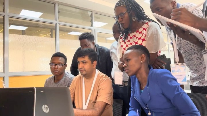
To test this concept and explore the potential of this new dataset in developing locally relevant landcover maps – I partnered with Google and WRI to develop a training workshop and host a 5-day “Mapathon” with participants of diverse backgrounds. The event was a mix of hands-on workshop along with hackathon-style group projects to use Dynamic World for a real-world application.
The workshop was hosted by Regional Centre for Mapping of Resources for Development (RCMRD) in Nairobi, Kenya. You can read more about the event in this article. I and Elise Mazur from WRI also gave a talk about our experience at Geo for Good 2023.


In this post, I want to share more technical details about the workshop materials and code for projects for those who may want to use Dynamic World for their own applications.
Part 1: The Workshop
I put together a new introductory workshop for Google Earth Engine that focuses on the Dynamic World dataset. The workshop consists of the following 4 modules:
- Change Detection
- Supervised Classification
- Time Series Processing
- Earth Engine Apps
The course material is open-source and freely available to anyone for self-study. Head over to the SpatialThoughts OpenCourseWare page to access the material.
Part 2: The Projects
We asked the group to form small teams having complementary skills and similar interests. The groups worked on projects to apply GEE and Dynamic World for their chosen application. We had a total of 7 projects and the teams presented their results on the last day. A panel of judges scored each project and the project Effects of Restoration Efforts in Maasai Mau Forest was chosen as the best overall project. The projects along with their final presentations, code, and apps are listed below.
Note: These projects are just prototypes and were put together in a short time during the mapathon without external validation or peer review.
| Project Title | Resources |
| Effects of Restoration Efforts in Maasai Mau Forest | [Presentation][code][app] |
| Change in Surface Water Extent of Lake Nakuru | [Presentation][code1][code2][App] |
| Crop Classification and Phenology | [Presentation 1][code][app] [Presentation 2][code][app] |
| Quantify Forest loss | [Presentation][code][app] |
| Urban Sprawl in Nairobi | [Presentation][code] |
| Quantify Vegetation loss caused by Desert Locusts | [Presentation] |
| Crop Type Monitoring | [Presentation][app] |
Overall the event structure having a hands-on workshop + team projects worked really well. The teams were able to make good progress and put together compelling prototypes of their ideas. GEE has a steep learning curve – and hence the ability to provide real-time mentoring to participants as they work on a project was very valuable. If you are considering teaching or hosting a Google Earth Engine workshop – I would highly recommend considering such a structure.