
QGIS User Conference 2023 took place in Netherlands on 18-19 April, 2023. This conference was organized by the Dutch QGIS User Group in the small town of ‘s -Hertogenbosch.
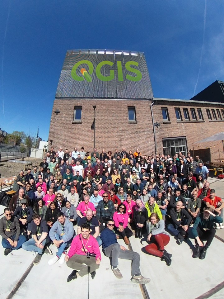
A long awaited community event that happened after a break of 3 years. The conference was attended by over 200 people from across the world. I got a chance to participate and meet many of QGIS community members in-person.
In this post, I hope to share some of my insights and resources from the conference.
The Location
The conference was hosted in the city of ‘s -Hertogenbosch (pronounced serto–hen–bos) -or Den Bosch for short – which is also the name of the latest release of QGIS version 3.30. I was able to reach a few days early and explore the city with some geo-friends and try out local delicacies.


The Venue
One of the unique aspects of the conference was the venue. The conference was hosted at Grasso – which is a refurbished factory now being used as an office building. It has large open spaces that was perfect for meeting people and informal discussions.


My Talk and Workshop
I delivered a talk on QGIS Applications for Urban and Regional Planning that showcase QGIS’s capabilities to solve problems in 6 different thematic areasLand Use Planning and Management, Crime Mapping and Analysis, Solid Waste Management, Urban Infrastructure and Utilities, Urban Transportation and Spatial Planning. As part of this project, I also released over 500 pages of open learning materials covering step-by-step instructions. [Presentation with links to resources].
I also launched a new workshop on QGIS Automation using Actions. This workshop covered Python Actions that allow you to customize and automate tasks in QGIS with a little bit of PyQGIS code. It is a good stepping stone for people who know Python and want to get into QGIS development. The workshop is now available publicly and is ideal for self-study. [Workshop Materials]


Resources
There isn’t a single place where all the conference talks and workshop resources were shared. I have a collected links to materials from the conference Telegram group and from the speakers themselves. I’ll keep adding links below as they become available.
Note: If you gave a talk at the conference and want to add a link here, please add a comment to the post. Some presentations are also available on Zenodo.
- Keynote: QGIS.org – The Importance of Seeding [slides1][slides2]
- Keynote: How QGIS assists the humanitarian work of Red Cross [slides]
- Talk: Publishing Maps with QGIS Server [slides]
- Talk: Spatially filtering your project’s layers for more efficient workflows [slides]
- Talk: QFieldCloud – efficient collaboration in the field [slides]
- Talk: News from QField – audio, video, map rotation and so much more [slides]
- Talk: Testing Spatial Data using QGIS and PyTest [slides]
- Talk: Mergin Maps platform for data collection [slides]
- Talk: From fieldwork to NDFF using Mergin Maps [slides]
- Talk: Advanced workflows with Mergin Maps [slides]
- Talk: Point clouds in QGIS: Now with Processing integration! [slides]
- Talk: Latest and future improvements in handling of 3D data in QGIS [slides]
- Talk: Association QGIS Peru promoting GIS networks in Latin America and Europe [slides]
- Talk: Monitoring-Crop-Water-Productivity-in-the-Mitidja-Plain,-Algeria-using-FAO-WaPOR-Data and-QGIS [slides]
- Talk: 2022 Brings Two New QGIS Books [slides]
- Talk: Equity Assessment for Transboundary Water Resources Management Using Remote Sensing Data and QGIS [slides]
- Talk: Presentation, instructions and data Making a promotion film using QGIS [slides]
- Talk: State of the PCRaster Tools plugin [slides]
- Talk: Imaging spectroscopy data in QGIS: Challenges and Opportunities [slides]
- Talk: Writing QGIS official documentation [slides]
- Talk: Finding small-scale sport spots in suburban areas using QGIS [slides]
- Workshop: QGIS Server With Python Superpowers [slides]
- Workshop: QGIS 3D, LiDAR Point Clouds and the Profile Tool [workshop materials]
- Workshop: Field Data Collection with QGIS and Mergin Maps [workshop materials]
- Workshop: QField and QFieldCloud – collaborate efficiently in the field [slides]
- Workshop: QGIS for Hydrological Applications [workshop materials]
Traveling to Europe from India is hard – both due to the logistics of the travel and the paperwork required to obtain a Visa. In the end, it was totally worth it as I was able to form numerous new connections and reinforce existing ones. Big congratulations to the organizing team for hosting a successful event!

Hi Sir, Highly Inspired!. Learning one by one all your teachings. I sincerely hope someday to work with you.
Thank you so much for your great contribution….. Hats Off
I was so great to get to know you and learn with your workshops, thank you!
Hey Aaron – Glad to meet you too. Stay in touch!
Hi Ujaval! Here are 4 presentations from Lutra folks:
https://docs.google.com/presentation/d/1uSB-ZX7UUmdcLTAm9SCSmW8e5QoQor9iQy8XNhT9SKo/edit?usp=sharing
https://docs.google.com/presentation/d/1tBU4DGpVZ-QLvwjaNDc-A2U96Rezxy0-AIJLxVsiBas/edit?usp=sharing
https://docs.google.com/presentation/d/1PC09HWX3D3RTIzYGICGoOAVP42YHiGcNN5DlcQg-DdM/edit?usp=sharing
https://docs.google.com/presentation/d/1QFfC0aAzUyP4QwXuXKd7GBhiCb_TP4Rm8yL8mTy3RAg/edit?usp=sharing
Thanks! I have added them to the post.
Hi Ujaval, it was a great pleasure to have finally met you.
Here is link to my talk:
https://docs.google.com/presentation/d/1uSB-ZX7UUmdcLTAm9SCSmW8e5QoQor9iQy8XNhT9SKo/edit?usp=drivesdk
Same here! Nice meeting you and learn more about Mergin Maps. I have already recommended one of my clients to try mergin maps for synchronizing their QGIS projects for their team!
[…] 2024. This is one of my favorite events of the year and I have been to the previous conferences in 2023 and 2019. The conference keeps getting bigger and attracts a more diverse audience. This edition […]
[…] in Norrköping, Sweden from 2-3 June 2025. I have been to the previous conferences in 2024, 2023 and 2019 and always look forward to the annual event. The conference keeps getting bigger and this […]