End-To-End Google Earth Engine
This course is no longer being offered.
See our new course Cloud Native Remote Sensing with Python for doing remote sensing using a fully open-source and platform independent approach.
- Level
- Intermediate
- Duration
- 27 hours9 sessions of 3 hours each over 3 weeks
- Prerequisites
- Familiarity with remote sensing concepts
Ways to take this course
This course is no longer taught as a live class. The material stays free to study on your own.
No longer offered
This course is not being taught as a live class any more, so there is no certification, support or mentoring with it.
Learning outcomes
- Implement remote sensing workflows in Earth Engine.
- Scale your analysis to large regions and over long periods of time.
- Build interactive apps for data exploration.
- Carry out time-series analysis and change detection with earth observation data.
- Use Machine Learning techniques with remote sensing datasets.
Course outline
- Course Pre-work (Self-study)
- Introduction to Remote Sensing
- Introduction to Earth Engine
- Module 1: Earth Engine Basics
- Hello World
- Working with Image Collections
- Filtering Image Collections
- Creating Mosaics and Composites from ImageCollections
- Working with Feature Collections
- Importing Data
- Clipping Images
- Exporting Data
- Module 2: Earth Engine Intermediate
- Earth Engine Objects
- Calculating Indices
- Computation on ImageCollections
- Cloud Masking
- Reducers
- Time-Series Charts
- Module 3: Supervised Classification
- Introduction to Machine Learning and Supervised Classification
- Basic Supervised Classification
- Accuracy Assessment
- Feature Engineering
- Using Satellite Embeddings
- Exporting Classification Results
- Visualize Exported Images
- Calculating Area
- Module 4: Change Detection
- Introduction to Change Detection
- Spectral Index Change
- Spectral Distance Change
- Direct Classification of Change
- Post-classification Comparison
- Module 5: Earth Engine Apps
- Client vs. Server
- Using UI Elements
- Building and Publishing an App
- Publishing the App
- Create a Split Panel App
- Module 6: Google Earth Engine Python API
- Introduction to the Python API
- Python API Syntax
- Automatic Conversion of Javascript Code to Python
- Batch Exports
- Using Earth Engine with XArray
- Automating Downloads
- Automating Exports
- Using the Google Earth Engine QGIS Plugin
- Guided Projects
- Project 1: Calculating Rainfall Deviation
- Project 2: Flood Mapping
- Project 3: Extracting Time-Series
- Project 4: LandCover Analysis
- Project 5: Extracting Nighttime Lights Statistics
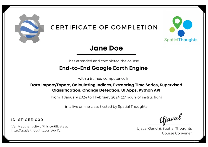
Certification
What participants say
I had a truly positive experience attending the Google Earth Engine course organized by Spatial Thoughts. The program was well-structured: from the fundamentals to the creation and publication of complete applications, each module was clear, useful, and full of practical insights. In particular, the final part dedicated to applications was eye-opening: the possibility to explore data interactively opens up huge opportunities for research and geospatial analysis. A great deal of credit goes to Ujaval Gandhi, who, with patience, clarity, and passion, made even the most complex concepts accessible. A special thanks also to Vigna Purohit, always available and attentive to the participants’ needs. I am grateful to have taken part in this course: it not only improved my use of GEE but also gave me concrete tools to work with greater awareness and efficiency. I highly recommend this course to anyone who wants to strengthen their skills in remote sensing and GIS.
Thank you, Spatial Thoughts!
Fabio CaccioppoStudent
The class was superb in all respects, and I would recommend it to any thoughtful beginner and user of Google Earth Engine. The genuine love for instruction comes through in Ujaval’s teaching method, and sincerity of care is evident in Vigna’s support.
Nitin PanditCTO, Ensys
I had an incredible experience attending the End-to-End Earth Engine course. The course was thoughtfully structured, taking us from the fundamentals of Google Earth Engine to building and deploying complete geospatial applications.
As someone who had already self-learned GEE, this course was the perfect next step. It helped me understand the finer details, best practices, and common pitfalls—greatly improving the efficiency and quality of my code.
What truly stood out was the supportive learning environment. Ujaval’s teaching was clear, engaging, and full of practical insights. Vigna was equally helpful and responsive throughout the course. The lifelong support offered by the Spatial Thoughts team makes this course an outstanding investment for anyone working in remote sensing or geospatial analysis.
I highly recommend it!
Thank you, Spatial Thoughts!
Thiyaku SIndependent
If you’re looking for resources to enhance your skills in GIS and remote sensing, Spatial Thoughts is an excellent place to start—whether you’re interested in free self-study materials or paid instructor-led courses. Under the guidance of the highly knowledgeable and experienced instructor Ujaval Gandhi, and with the support of training associate Vigna Purohit, I’ve been able to learn Google Earth Engine (GEE) far beyond what I initially expected. The platform offers a wealth of learning materials, ranging from basic to advanced topics. One particularly valuable feature is the “Suggested Learning Paths” in their website, which helped me, as a beginner, step into the world of GIS with greater confidence. Additionally, Spatial Thoughts offers exceptional after-class support, which has been crucial for applying what I’ve learned to my own real-world projects.
Thank you, Spatial Thoughts!
Chi DoAthena IR Tech
I am a geoinformatics enthusiast based in Bangladesh, with experience working on national and regional scale conservation programs through organizations like Chemonics, USDA Forest Service International Programs, UNDP, and Academia. Recently, I took the End-to-End GEE course with Spatial Thoughts, and I must say it exceeded all my expectations. The contents were well-structured, specifically hands-on exercises that helped me a lot. The instructor Ujaval and TA Vigna, were both very knowledgeable and responsive to our queries during and beyond the live sessions. I really appreciate Spatial Thoughts’ commitment to writing efficient codes for real-world geospatial problems and making the learning resources freely accessible for the community. The best thing is that you will not feel left out during the training. I believe this training has boosted my confidence in GEE geospatial applications. I highly recommend this course who want to learn from the domain experts with an outstanding learning experience.
Sahadeb Chandra Majumder
“End to End Google Earth Engine” by Spatial Thoughts is an absolutely fantastic course! It’s super useful and exactly what I was looking for. The way the course is structured, from the very basics to advanced topics - is just amazing. Everything is explained clearly, with a step-by-step approach that makes even complex concepts easy to grasp. The 3-hour classes were incredibly engaging, packed with hands-on demos and practical exercises that really helped solidify the learning. I never felt like I was just passively watching - it was interactive and very well-paced. Huge shoutout to Ujaval sir and Vigna ma’am, they’re excellent instructors. Ujaval sir’s knowledge of Google Earth Engine is truly impressive, and it reflects in the way he teaches. His ability to break down complex topics and explain them in a simple, relatable way made a big difference. Vigna ma’am was equally amazing and always ready to help. One of the best parts of this course is the lifetime technical support. That’s such a valuable feature, especially for someone like me who plans to apply everything I’ve learned in my PhD research. Knowing I can reach out for guidance in the future gives me a lot of confidence moving forward. Highly recommend this course to anyone looking to master Google Earth Engine in a practical, well-supported way!
Nishtha SharnagatResearch Scholar, Banaras Hindu University