
The aim of this course is to introduce Google Earth Engine platform to apply remote sensing techniques using openly available Earth Observation datasets. The course also teaches participants how to build water-related applications for state and country-wide analysis, mapping and monitoring. We cover applications for surface water mapping, trend analysis, landcover mapping, flood mapping, and drought monitoring.

Duration
27 Hours (Typically conducted in 9 sessions of 3 hours each over 3 weeks)
Prerequisites
- Familiarity with remote sensing concepts.
Learning Outcomes
- Apply remote sensing techniques and implement solutions to water resource management workflows in Earth Engine.
- Learn to use Earth Engine API effectively and write scripts optimized for parallel-computing.
- Scale your analysis to large regions and over long periods of time.
Course Outline
Module 1: Google Earth Engine Fundamentals
- Introduction to the Code Editor
- Fundamentals of Javascript programming
- Working with Image Collections
- Working with Feature Collections
- Creating Mosaics and Composites
- Calculating Indices (NDVI, MNDWI, AWEI)
- Computation on Images (Simple Thresholding, Raster Algebra)
- Exporting Raster Data
Module 2: Surface Water Mapping
- Introduction to Water Detection Techniques
- Simple Thresholding
- Dynamic Thresholding using Otsu’s method
- Unsupervised Clustering
- Introduction to the Global Surface Water (GSW) dataset
- Extracting Seasonal and Permanent Waterbodies
- Image Processing (Kernels, Convolutions, and Morphological Operations)
- Image Masking
- Raster to Vector Conversion
- Exporting Vector Data
Module 3: Precipitation Time Series Analysis
- Introduction to Gridded Precipitation and Climate Datasets
- Map/Reduce Programming Concepts
- Calculating Total Rainfall in a Region
- Creating Time-series Charts
- Exporting a Time-series of Rainfall in a Region
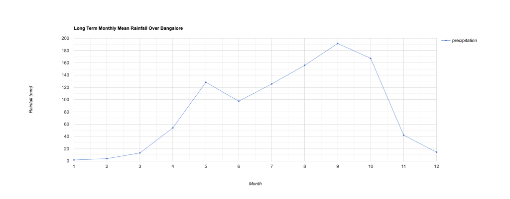
- Calculating Long-Term Monthly Average Rainfall
- Trend Analysis using Sen’s Slope Statistic
Module 4: Land Use Land Cover Mapping
- Introduction to Machine Learning and Supervised Classification
- Land cover classification
- Accuracy Assessment
- Calculating Area
Module 5: Flood Mapping
- Introduction to Radar Remote Sensing
- Visualizing SAR Imagery
- Change Detection Methods for Detecting Floods
- Rapid Flood Mapping using UN-SPIDER methodology
Module 6: Drought Monitoring
- Introduction to Drought Mapping and Monitoring
- Preparing Long-Term MODIS NDVI Time-Series
- Calculating Vegetation Condition Index (VCI)
Module 7: Earth Engine Apps
- Client vs. Server Concepts
- Building an App with UI Widgets
- Performing Calculations
Assignments
- Assignment 1: Extracting Waterbodies in a Watershed
- Assignment 2: Time Series Analysis of Evapotranspiration


Certification
Upon successful completion of all the live online sessions and completing the assignments, participants will be issued an employer-verifiable certificate from Spatial Thoughts. Learn more.

Learning Mode
All our courses are available for free for self-study via our OpenCourseWare site. We also offer the courses as cohort-based online classes with certification and support.
| Self Study | Live Classes | |
|---|---|---|
| Instruction method | Pre-recorded videos | Live Instructor-led Zoom Sessions |
| Certification | ❌ | ✅ |
| Lifetime Technical Support | ❌ | ✅ |
| Mentoring | ❌ | ✅ |
| Cost | Free | USD $229 / INR ₹15,999+GST |
| Start Learning ↗ | Sign-up For a Class ↗ |
Course Reviews

For the 2nd and 3rd week of the class, I’ve been experiencing poor internet because of the typhoon. I got worried because I was thinking that it would be much harded for me to not be on live. But, I was wrong. The team’s approach has made my catching up through recorded videos very easy. The materials are all provided, questions are catered through email, and the additional materials are all provided. The team is not gatekeeping! That’s why they are very blessed and I’m declaring for more!
Alex Maverick C. Pabillaran, GIS and Remote Sensing Staff, DOST – Northern Mindanao (Project SARAi)

I had a wonderful experience participating in the Google Earth Engine for Water Resources Management course. The instructors explained complex concepts clearly and engagingly, supported by practical exercises and real-world case studies. The workshop was even better than I expected—everything was well organized and on time. I especially enjoyed the coding exercises, and the materials and recordings are very helpful for practice and revision. The course strengthened my coding confidence and introduced me to valuable datasets and workflows essential for water resource applications. I highly recommend this course to students, professionals, and researchers who want to enhance their skills and apply GEE effectively in their work.
Kushal K.C, Satellite Data Analyst, Antarikchya Pratisthan, Nepal.

I had the opportunity to participate in the Google Earth Engine for Water Resources Management course offered by Spatial Thoughts, and it was an incredible experience. Spatial Thoughts offers two scholarships for each course, and I am fortunate to be one of the recipients of this opportunity, which covered the course fees. The commitment and profound skills demonstrated by Ujaval, the instructor, truly empowered me to code with Google Earth Engine. I highly recommend taking any courses provided by Spatial Thoughts, as they provide valuable knowledge that can enhance your skills in the field of water resources management and beyond.
Jemal Mohammed Hassen, Researcher, Ethiopian Institute of Agricultural Research/Werer Agricultural Research Center, Ethiopia.

As a global Water, Sanitation, and Hygiene professional, the skills learned in GEE for Water Resources Management will be essential to informing our teams about impacts on water security around the world. Though I have taken the End-to-End GEE course, I still learned new and valuable datasets and applications that are possible within Earth Engine for the sector. Another great class from Spatial Thoughts!
Zach Torres, Digital Monitoring & Mapping Project Manager, World Vision, United States

Once again, I had an incredible experience learning advanced concepts with Applications using GEE. And yes, I have more questions now than before given the wide scope of Google Earth Engine’s ever-evolving competency.
Mehreen Khan, WRI, India.

This course was great. The professor is really good. He has lots of knowledge and is super willing to help and explain things very clearly. I strongly recommend this course if you want to learn Google Earth Engine related to water resources.
Adriana Castillo, PhD Candidate, University of Minnesota, United States.

I greatly enjoyed Ujaval and Vigna’s teaching method and materials. I have learnt quite complex GEE code for real application scenarion; I definitely recommend this course for students and practitioners.
Emanuele Clemente, Economist, World Bank, Italy.

Coding and programming has always been my weak point. I have always wanted to learn Google earth engine but dreaded it and continued using proprietary softwares as I had a fear of coding. Through this training I realised that Google earth engine doesn’t require hard core coding but simple APIs.
Pema yangzom,Superintendent survey engineer, NLCS, Bhutan.
Although some exercises were challenging , the resource person Mr.Ujaval Gandhi was always there supporting me and answering all my doubts.I had a very wonderful experience learning and look forward to more trainings from Spatial Thoughts in the future.
Thank you so much for an amazing Google Earth Engine for Water Resources Management course! I learned so much. Specially, the exercises in each chapters and assignments made the course most interesting and easier to follow through real-world data and case studies. Moreover, availability of the course material and recorded videos are both comprehensive and informative.
Shimelis Abebe Tegegn, Sweden.

This is a must for everyone interested in taking their use of Google Earth Engine free access data for Water Resources Management to the next level! Great information, so many things that are shared during the classes and amazing expertise from the organizers.
Jorge Esteban Masis Aguilar, University of Costa Rica, Germany.
Quite useful if you have already watched some of Spatial Thoughts videos and you already have been “playing around” with GEE, as well. Highly recommended.

I thoroughly enjoyed all the training sessions. The training modules were comprehensive and well organized. Ujaval is a wonderful and knowledgeable instructor.
Aashutosh Aryal, Centre for Integrated Urban Development, Nepal.

Amazing course! Excellent and detailed examples and lots of additional information. I gained knowledge and useful skills for my work and research. The instructors were always willing to answer every question and solve our problems. It’s a highly recommended course.
Evita Koltsida, National Technical University of Athens, Greece.

This being the second GEE course I have taken with Spatial Thoughts Academy, I was very impressed by the curriculum developed for this course. The deep dive into various concepts of water management was amazing. I acquired new skills that will help in improving and advancing my GEE analysis. I was also very inspired by the many datasets that are introduced throughout this course, which I can adopt for my analysis in the future. Special thanks to Ujaval and Santhosh for putting up this amazing GEE for Water Resources Management course. I acquired immense skills that I will put into my daily analysis with GEE. Overall, the course delivered and surpassed my expectations.
John Waweru, University of Bonn, Germany

This is my second course I am taking with Ujaval and Santhosh. They are professional, helpful and materials are amazingly done. I am satisfied with the course.
Hajar Choukrani, IAV Hassan II – L’institut Agro Montpellier, Morocco

The workshop was a great experience for me as the learning platform gives one a chance to experience life amazingly. Not only have I learned new concepts but also every activity and interaction helped me gain new skills, experiences, empowerment, and exposure hence molding my personality. I thank the presenter(Ujaval Gandhi) and the support team (Santhosh M) for enriching my knowledge of Geographic Information Systems.
Kevin Kipchoge, Dedan Kimathi University of Technology, Kenya.

I was wondering how I am going to complete my Master Thesis without this course. All the required material is now there. I am grateful to you for your time in designing this course.
Adithya Ganapathi Valivety, Asian Institute of Technology, Thailand.

I have been waiting to take a course like this ever since I started using Earth Engine. I found it easy to follow along, and the interactive nature of the course kept me engaged. You are provided with great resources and ideas through the course content, in supplementary scripts and through their main webpage. The instructors are personable and knowledgeable. I would recommend this course to anyone interested in using Earth Engine for their work, the skills are applicable to many other focuses outside of Water Resources Management as well.
Tachara Larocque, Environment and Parks, Alberta Government, Canada

It’s been a while that I know Ujaval’s work and free tutorials. When I finally got a opportunity to buy the Google Earth Engine for Water Resources Management Course, I got surprised with several things, such as the explanations (Ujaval and Santhosh are very clear and always willing to help) and the powerfulness of the platform. Now I feel that I can develop new products back in my researches and jobs, leading to a better observation of water resources and generating more insights with a huge variety of data.
Rodrigo Brust, MDGeo, Brazil

A very good experience of managing spatial database. Clear explanations through programming code and a very good disposition to answer questions.
Claudio Reyes Reyes, Chile

This course was one of the most useful, well organized, well thought out and presented courses I have taken. It greatly increased my knowledge and familiarity with both analysis techniques and Google Earth Engine itself. Ujaval and Santhosh were very supportive and helpful and the exercises mesh very well with the training. I highly recommend it.
Corinne Benedek, University of Cambridge, United States of America

Excellent course! I have learnt so much about how to utilize earth observation water resources data in Earth Engine! I find time-series analysis, flood mapping, drought monitoring, and app development materials offered in this course extremely useful!
Subir Chowdhury, Alberta Geological Survey, Canada

Great course with tons of knowledge to unpack. The teachers are very professional and knowledgeable. Highly recommended.
Elbys Jose Meneses Ortega, DHI Group, Denmark.

This course set the right path for me to start my journey with Remote Sensing. Working in the humanitarian sector in a country heavily affected by Climate Change, this course provided me with the basic and intermediate skills that I need to make a real impact.
Ahmad Fandy, REACH Initiatives, Iraq.

The lecture on the Google Earth Engine For Water Resources Management was fantastic to me. I gained a great deal of knowledge from both Ujaval Sir and Santhosh Da. I completed the course with a wide range of practical knowledge and skills. The course is well-structured, and the content is presented understandably. I wholeheartedly recommend this class to others.
Deb kumar Maity, West Bengal State University, India

Loved the sessions. The whole course was very well laid out and detailed. Even though I had a very less experience in this domain, I could grasp a good amount to knowledge delivered. Really appreciate the help and the Q&A sessions.
Shreyansh Vishwakarma, IGIDR Mumbai, India

I took this course after attempting to demystify and understand how Google Earth Engine works and take advantage on how to apply it in remote sensing data related to water resources. Excellent examples, a great structured program and plenty of experience are put to the service of the students. Every day, new material was received based on student’s interests and class discussion. Highly recommended. Thank you, Ujaval and Santhosh, for another great course!
Norman Avila, Climaya, Guatemala.

I was skeptical about taking this course initially as I had taken a similar course on GEE, but a friend urged me to take it. I was very surprised how much more knowledge Ujaval exposed me to. In the end, I did not only grab tips, tricks and more applicability especially workable workflows but also an in-depth understanding of GEE and even advanced features. I recommend this course to everybody, including experts in the Remote Sensing field.
John Dogbey, Deutsche Gesellschaft, Ghana

The course has greatly helped my understanding and implementing of big data application on GEE (particularly on water resource management) . The instructor is well vast on the subject in addition to being a great teacher. This course is highly recommended.
John Oluwagbemiga Fadamoro, University of Bonn, Germany