Advanced QGIS
- Level
- Intermediate
- Duration
- 12 hours4 sessions of 3 hours each over 2 weeks
- Prerequisites
- Familiarity with QGIS
Ways to take this course
Every course is free to study on your own. The live classes add certification, support and a cohort to work through it with.
Cohort-based, with certification
- Live instructor-led Zoom sessions
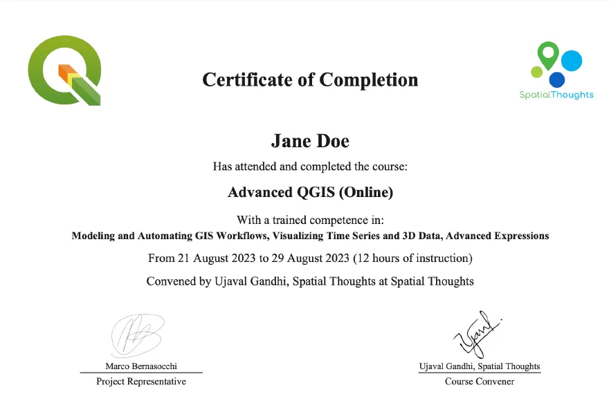
- Official QGIS.org certification
- Lifetime technical support
- Mentoring
Next class: January 2027
US$149 · ₹10500
Notify me when it opensLearning outcomes
- Automate GIS Workflows
- Increase productivity and reduce errors
- Create beautiful visualizations
- Solve complex spatial analysis problems
Course outline
- Module 1
Processing Framework
- Introduction and Course Overview
- Processing Toolbox (Hands-on)
- Batch Processing (Hands-on)
- Module 2
Model Designer
- Workflow Automation (Hands-on)
- Spatial Indexing
- Best Practices for Scaling and Data Management (Hands-on)
- AssignmentCalculate Highway Statistics
- Module 3
Animations
- 2D Animations (Hands-on)
- 3D Animations (Hands-on)
- Optional AssignmentCollect a GPS Track
- Module 4
Expressions
- QGIS Expressions (Hands-on)
- QGIS and AI
Automating QGIS with AI Agents
- QGIS and AI
- Automating QGIS with MCP Server (Demo)
Certification
What participants say
Ujaval Gandhi is an extraordinary, globally recognized teacher who, like all brilliant people, does not need to give himself importance. In this course I had the opportunity to interact with him, the class and his very talented collaborator Vigna receiving answers to all the questions asked. Unlike the self-study tutorials I had the opportunity to receive explanations of the assigned tasks and was shown how each problem can be solved in different ways. In addition to the course material, additional information/explanations and links are given to expand on the topics covered and the recorded lectures are shared so that they can be reviewed to catch missed information during the online course. Qgis is an amazing software, with a fantastic community, deserving of donations, the nightmare of proprietary GIS software.
Manolo TerranovaArchitect & Land Surveyor
Spatial Thoughts’ training packages will demonstrate to you the strengths of QGIS and will make you fall in love with QGIS. I took the Advanced QGIS course and really learnt wonderful things that will make my work easier and faster. Ujaval himself is a world of GIS and He has been gifted with superb teaching skills. Thumbs up Spatial Thoughts!
Isah Abdullahi TankoNigerian Meteorological Agency (NIMET)
Great course that helped me learn a lot of new things and further improve my knowledge and skills in GIS and QGIS.
I especially enjoyed the practical workflows and hands-on learning approach throughout the course. Looking forward to applying these skills and building some great GIS projects in the future.
Thanks to Ujaval Gandhi sir for such a valuable learning experience!
Subham SharmaIIT(ISM) Dhanbad
It was my distinct privilege to take the Spatial thoughts Advanced QGIS course. Ujaval Gandhi and his training associate, Vigna Purohit, provided an excellent presentation of the QGIS model designer and processing toolbox. Ujaval’s expertise is unsurpassed, yet he was very patient with all the learners in the class–particularly with me, someone who is just learning the nearly unlimited possibilities of QGIS. I highly recommend Spatial Thoughts, and I plan to continue to learn with them.
Martin BraatelienPhD, Research Analyst, Consor Engineers
I was already going with high expectations to start this course, and it still managed to surpased them! Both Ujaval and Vigna were highly reliable, patient, and helpful with any doubt one of us had.
Definetively, he strong aspect of this course is its practical side, as it makes you put into practice what you are learning in real time, rather than just watching. On top of this, the assignment I believe is a spot-on decision, as it challenges you to implement what you’ve learned throughout the course.
If you are hesitating about taking this course, look no further! This is the perfect combination of highly didactic classes and challenging hands-on QGIS situations.
Luciano RivasUniversity of Groningen
This was such a thoughtful and insightful course. I’m incredibly grateful to have received this scholarship as a young researcher, writer, and schoolteacher balancing multiple commitments. Even during the parts of the course that required a great deal of review and learning, I always felt supported. As a teacher myself, I’m constantly struck by the incredible scope of what QGIS can make possible—especially in helping visualise complex data and turn it into clearer, more meaningful stories for younger audiences. Its ability to make big data accessible and engaging has really expanded the way I think about teaching, research, and community-based work. Ujaval was exceptionally patient throughout, and I have him to thank for helping broaden my thinking about what these tools can do and how I might apply them more intentionally in my own work.
Shumin TanEducator and Researcher